Klamath River Flood Maps and Risk
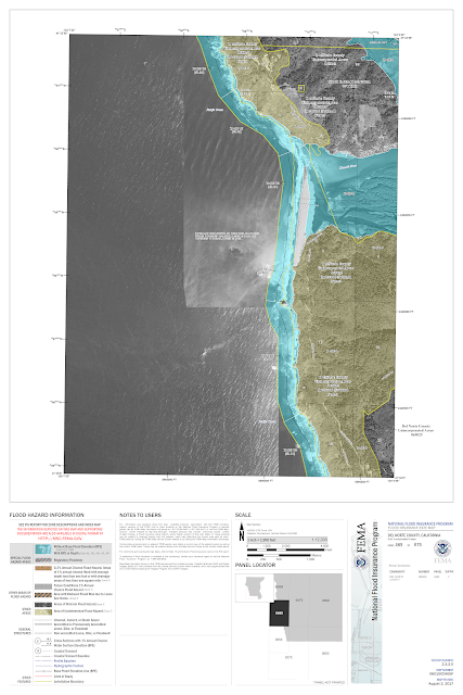
For this assignment I really enjoyed using FEMA's National Flood Hazard Layer (NFHL)Viewer. From the flood data research earlier in the semester, I found that the two most likely sites for flooding on the Klamath were from the confluence of the Trinity downstream to the mouth of the river at the Pacific Ocean near Klamath and Requa, CA. Its a very interactive ArcGIS site where you can follow the length of the river and it will layer in blue the possible flood plain. The maps are divided into FIRM Panels and you can zoom in and download each panel. This is the the Pacific to the Trinity River:
Clearly some of the files download differently, but on the site, you can zoom in all in color, and the basic blue layer of the flood plain usually is marked with the letter A. It was helpful to explore the Klamath County Flood Insurance Site to understand what the lettering meant. On this site, a landowner or homeowner can search their parcel and and out if they are at risk of flooding and if so, if flood insurance is mandatory. This site also uses the ArcGIS run FEMA Viewer:
This video also is helpful in identifying the different kinds of floodplains, an overview of Property ID flood maps, and how they may be used to identify what these changes mean to property owners in Klamath County:
I would venture to say that these two tools are useful for existing structures for sure. It also gives a clear picture of the risks and expectations in developing flood prone areas. The question of whether or not current land uses are appropriate is a deeper question. Zone A development is based on 1 percent chance annual flood event, so a homeowner or developer is always playing the odds. I personally would never want to live or build in a flood zone, but others are willing to take the risk for location. As compared to some east coast and southern regions, the Klamath, given its length, is not especially prone to floods, and those where it is possible are unsurprising, near the Pacific where tide can intensify flooding, and in a lush river valley, where flooding can aid in the agricultural life of Seiad Valley.


Comments
Post a Comment