Posts

Showing posts from September, 2023

Klamath River Flood and Drought Data

Image
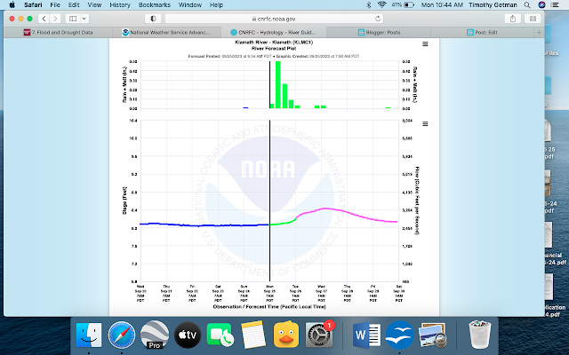
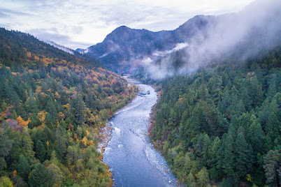
So, this was fun to look at the different present and historical data from the river. Coincidentally, there is A LOT of rain forecast for this week in the region, so I was interested to see what was going on on the Klamath. There actually is a flood watch but not for the river itself. Many streams and hillsides are covered in burn scars and debris from the recent fires in the area, so there is risk of tributary streams and creeks clogging and filling up but not the river itself. I looked at the the NWS link for Advanced Hydrologic Prediction  https://water.weather.gov/ahps2/index.php?wfo=mfr  and the California Nevada River Forecast Center (CNRC)  https://www.cnrfc.noaa.gov/graphicalRVF.php?id=SEIC1 . Both use NOAA data and are set up a little differently, but similarly show the present week and forecast (screenshot 1), historical flood or crest data (screenshot 2), and what kind of impacts different river levels would have on the area. I have so many screenshots below because the Klam

Features and Characteristics of the Klamath Basin

Image
  I am not a geologist, but I am fascinated how landscapes were formed. One cannot examine the Klamath River’s features and characteristics without looking at how it began. Alex Schwartz, of Herald and News (who has a better understanding of geology) is quoted here: "Around 20 million years ago, North America began to stretch like taffy. The Earth’s crust expanded into what is now the Great Basin, forming thousands of parallel cracks running north to south. As the stretched crust became thinner, heat from the Earth’s mantle pushed the fractured land upward, and it rose and fell along the small fault lines. This formed a vast network of mountain ranges and valleys called the “basin and range” that stretches from south central Oregon all the way to New Mexico. This short video from the National Park Service shows how the basin and range was formed:                                        About 13 million years later, the oceanic Juan De Fuca Plate slid beneath the North America

Mapping the Klamath

This is a brief slideshow for our Map Your Watershed assignment for Watershed Stewardship at Virginia Tech. Also below see a fun interactive watershed mapping program called River Runner . You can drop a raindrop anywhere in your watershed (or anywhere in the world for that matter and watch its flow). The first is from Upper Klamath Lake to the Pacific Ocean, and the second is from Crater Lake to the ocean. Enjoy! https://river-runner.samlearner.com/?lng=-121.93014360470823&lat=42.43474703092204 https://river-runner.samlearner.com/?lng=-122.10710892006037&lat=42.92410178283885

The Klamath River: Decades of Conflict Transition to an Era of Rebirth

Image
                                                                                                     Klamath River | Photo by Shane Anderson Studying the wicked problems of sustainability in the 21st century through the Virginia Tech Online Masters of Natural Resources is incredibly edifying and continues to shed light on many of the greatest challenges of our time. But one can find themselves feeling pretty powerless and occasionally hopeless in the face of natural disasters, droughts, poverty, and worldwide policy change that continues to move at a glacial pace. So I have decided to immerse myself in the story of the Klamath River, a narrative that seems, at the present moment, to show signs of hope. The Upper Klamath River Basin was once known as “the Everglades of the West," its two enormous lakes boasting teeming wetlands, the path for 80% of the Western US’s migratory birds, and overflowing with fish, including the two species of sucker fish sacred to the Klamath Tribes, the